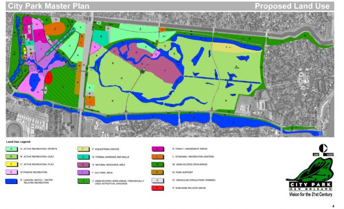
Unfortunately, open green space and natural resource areas have clearly suffered a setback in this new version of the land use map, as compared to both the existing use and the original planned use from the 2005 Master Plan, shown above. The Softball Complex and police stables have vanished, devoured by the proposed new golf courses, which are back to consuming approximately 48% of the space in City Park. On the south side of I-610 (to the right in these maps), additional development has further reduced the amount of passive open green space available to park users.
The new course supporters are fond of using the number "400 acres" to describe the amount of land the new courses will occupy in the park. Keeping in mind that the entire park is said to be 1300 acres, then using simple math, 400 acres would occupy less than a third of the park.
It didn't take a rocket scientist to look at the map and see that the "400 acres" figure was wrong, and the CPIA finally admitted that they were only counting land mass and not water acreage. Which begs the question: why did they keep using that disingenuous number, and what else are they trying to hide?
However, please take note that the borders of the Couturie Forest's "natural resource area" continue to remain intact in relation to the old golf course footprint.
)